Why it matters
A route that looks short on a map can be slow or hazardous underfoot. Turning around early is a normal route decision; distance alone does not measure difficulty.
What you’ll need
Tools
- Current map and forecast
- Appropriate footwear
- Communication plan
Materials
- Route alternatives
- Water and essential gear
Before you begin
Safety & limits
- Do not cross unstable slopes, moving water or exposed ground beyond your training. Call for help early when injury or loss of route is possible.
- This page is a decision framework, not instruction in technical climbing or swift-water crossing.
Work carefully, in order
The method
- 01
Read the route
Compare the mapped surface, elevation, daylight and known closures with the group’s actual capability. Record turn-back points and a safer alternative.
- 02
Check conditions on arrival
Look for loose rock, slick roots, ice, water, overhead hazards and weather change. Do not assume a prior trip proves today’s route is safe.
- 03
Use a small test section
On a reversible part of the route, assess traction and pack balance without committing the whole group. Return if the surface or exposure is beyond your plan.
- 04
Apply a turnaround rule
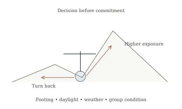
Compare progress with time, remaining daylight, water and group condition. Choose the alternative before fatigue removes options, and communicate the change.
- 05
Document and debrief
Mark hazards on the route note and tell the person holding the trip plan of changes. If someone is hurt or cannot safely move, use the emergency plan.
Mistakes to avoid
- Treating a direct line as the safest path
- Pressing on because the destination is close
- Crossing high water to avoid retracing steps
If it isn’t working
Weather closes the route
Turn back or use a pre-checked safer route before exposure increases.
A group member cannot continue
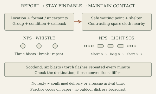
Stop in a safer place, assess immediate hazards and use the emergency communication plan.
Then & now
Historical context
Route finders combined ground observations with maps and weather. Current forecasts and managed-trail notices provide additional reasons to change a plan.
The modern equivalent
A managed accessible path or guided route reduces navigation and terrain uncertainty where available.
Sources & review
Editorial draft — specialist review pending. Written 2026-09-24. Sources support the stated scope; this page has not been professionally certified.
- National Park Service — Hike Smart ↗
Trip plans, weather decisions and emergency preparation. Checked 2026-09-24.
- National Park Service — Outdoor Emergency Plan ↗
Communicating a trip plan, staying put when appropriate and making a location visible. Checked 2026-09-24.
- Leave No Trace — Seven Principles ↗
Land-manager rules, durable surfaces and pack-out practices. Checked 2026-09-24.